Crowdsourced Mapping Summary
Crowdsourced Mapping Summary
Mobileye
https://www.mobileye.com/our-technology/rem/
DeepMotion
http://chizhang.me/ (vision based crowdsourced mapping, multi-journey fusion and auto lane topology deduction)
Argo.AI
http://www.cis.rit.edu/~glpci/vocvalc2021/speaker/
Huawei
RoadMap: A Light-Weight Semantic Map for Visual Localization towards Autonomous Driving
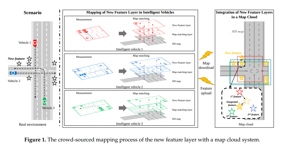
The paper proposes using sensor-rich vehicles for on-vehicle crowdsourced mapping. The crowdsourced local maps are aggregated in the cloud, the aggregated global map is compressed in the cloud, and the compressed map is transmitted to the vehicle and decompressed, finally using on-vehicle perception for localization. (Of course, if low-cost on-vehicle localization is eventually accurate enough, low-cost vehicles can also be used for crowdsourced map updates.) So a sensible pipeline is as follows: use maps from third-party map providers or crowdsourcing from robotaxi vehicles to form a base map, then maintain it in the cloud and perform map fusion, and finally perform map updates while localizing on consumer-grade vehicles.
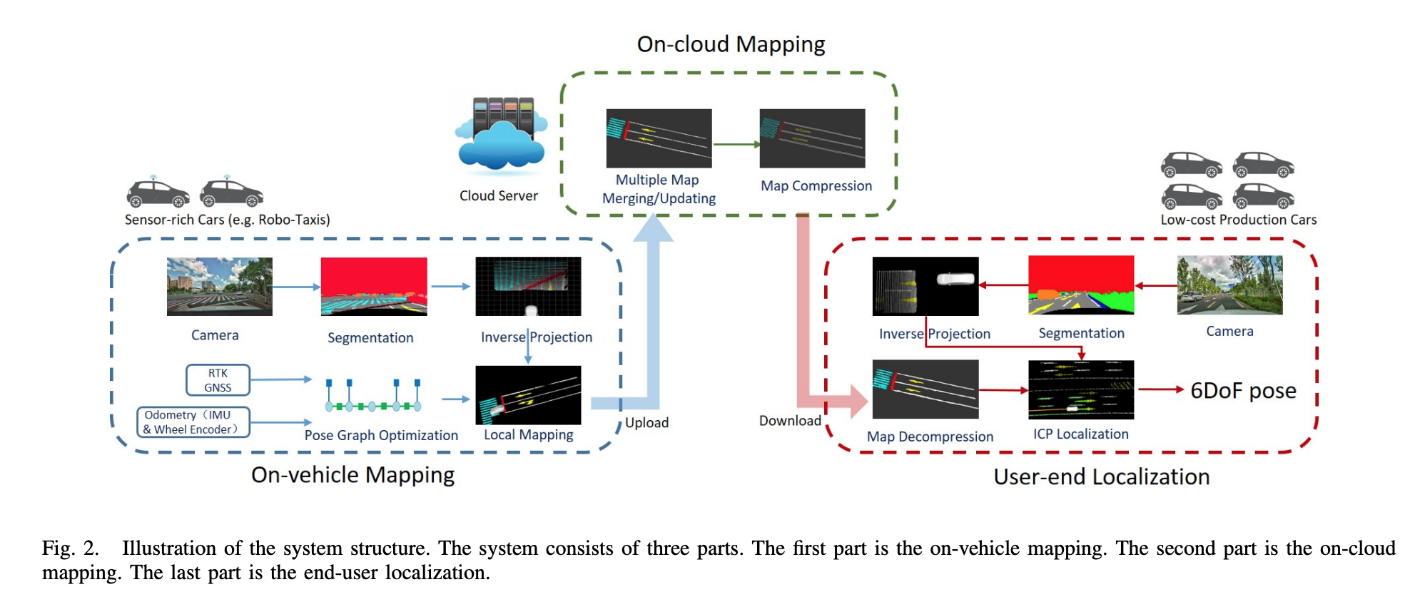
vehilce mapping
First, semantic segmentation is performed on the original image. Then the segmented pixels are projected into the vehicle coordinate frame using the camera’s intrinsics and extrinsics relative to the vehicle. Because of the noise in image segmentation, only the ROI region inside the red box is back-projected. 
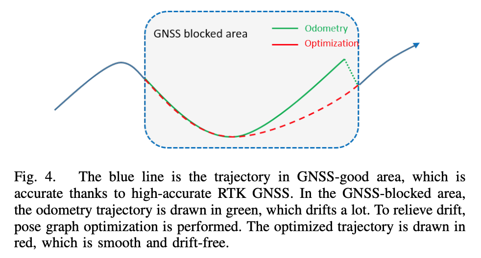
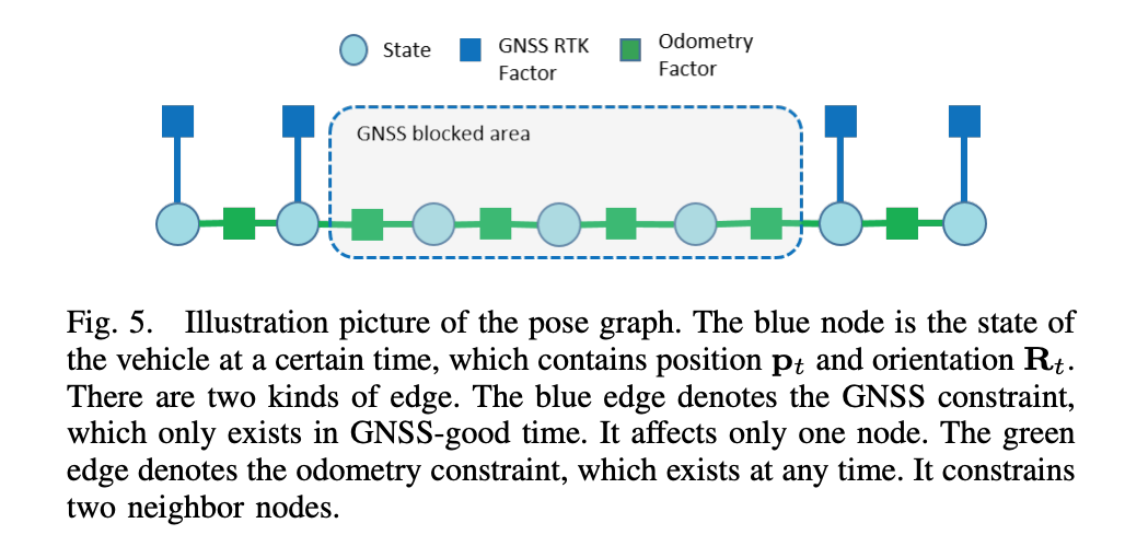
Because mapping requires accurate poses, and RTK-GNSS already provides centimeter-level localization in unoccluded areas, pose-graph optimization is used to average out pose errors and obtain continuous, consistent poses, so that occluded areas also achieve high localization accuracy.
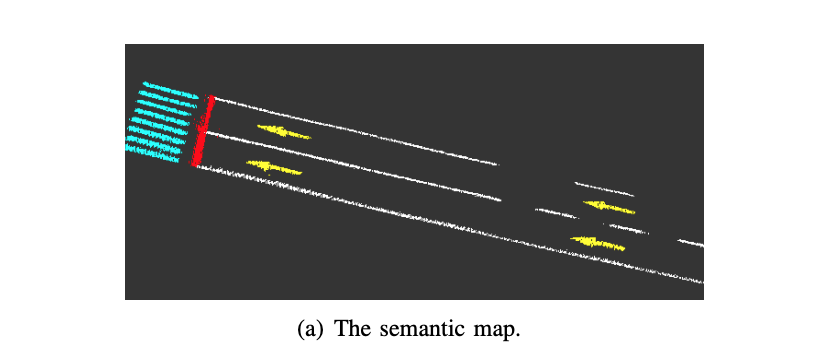
Because of segmentation noise, observations from multiple frames are used to determine the class corresponding to a given map location. The map is divided into grids of 0.1 * 0.1 * 0.1, and each grid cell contains a position, a semantic label, and the count of each semantic label. When a semantic point of the corresponding class is inserted into a grid, the count of the corresponding label of that grid is incremented by 1. Finally, a max-voting, winner-takes-all scheme is used to decide the grid’s class.
cloud mapping
The cloud is responsible for aggregating the local maps built by vehicles over multiple drives. To save bandwidth, only occupied grids are uploaded. The semantic map in the cloud is also divided into grids, and the grid scores of the local maps are added to the corresponding grids of the global map.
To further save bandwidth, the map transmitted to the vehicle is compressed, reducing the map size through contour extraction.
user vehicle localization
During localization, the current map points in the perceived vehicle coordinate frame are registered against the map points in the semantic map via ICP to estimate the current vehicle pose. An EKF is introduced to couple the odometry observations and output a smooth trajectory.
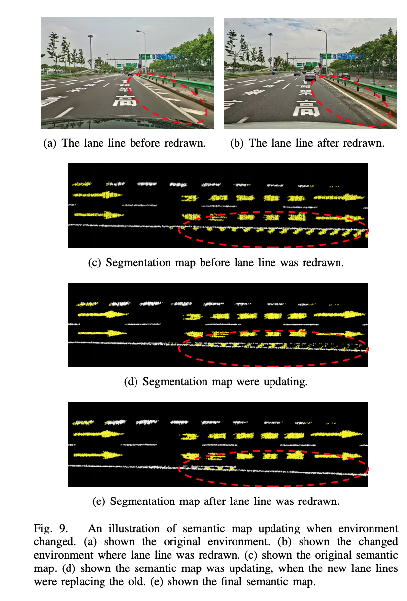
Progressive results of the map update:
Momenta
https://www.momenta.cn/en/apply.html
KuanDeng
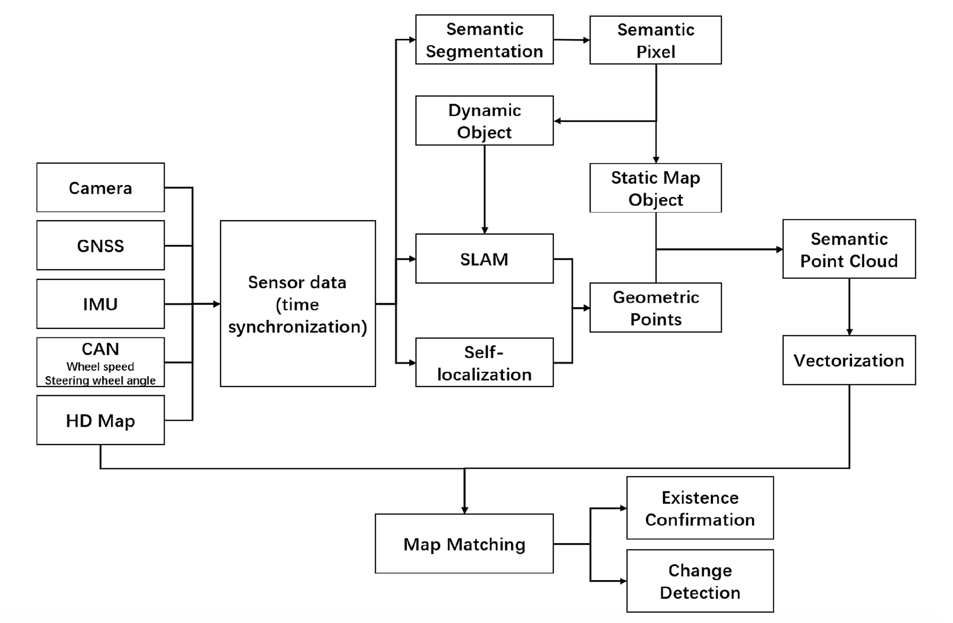
- Real-Time HD Map Change Detection for Crowdsourcing Update Based on Mid-to-High-End Sensors (sensors 2021)
Hanyang University (korean)
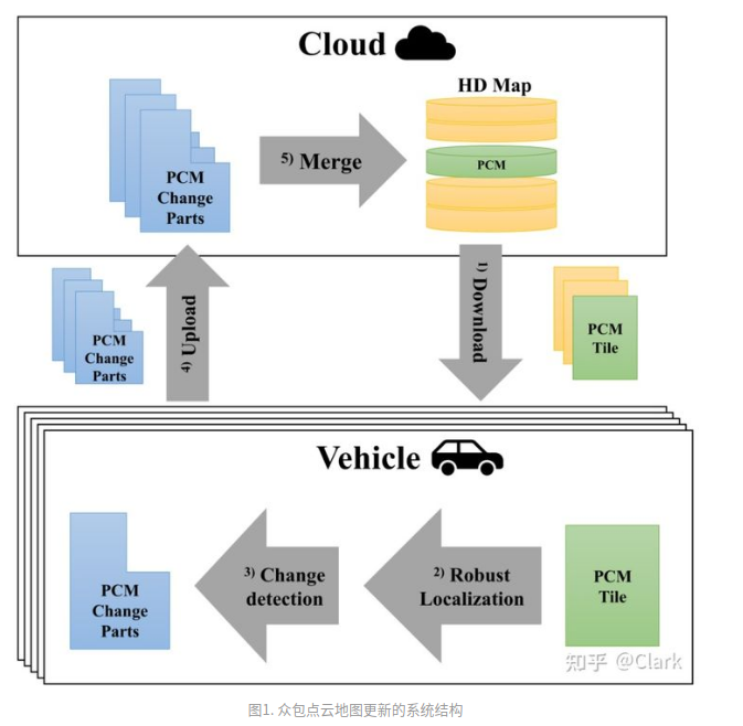
- download
- robust localization
- change detection
- upload
- map merge
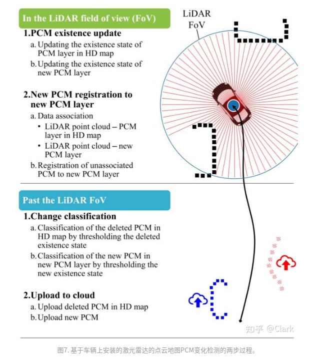
- When passing through the lidar FOV
- Detect, via thresholding, the deleted point-cloud map and the newly-added point-cloud map
- Upload the deleted point-cloud map and the newly-added point-cloud map separately
When within the lidar FOV
Update existence status, data association, and registration
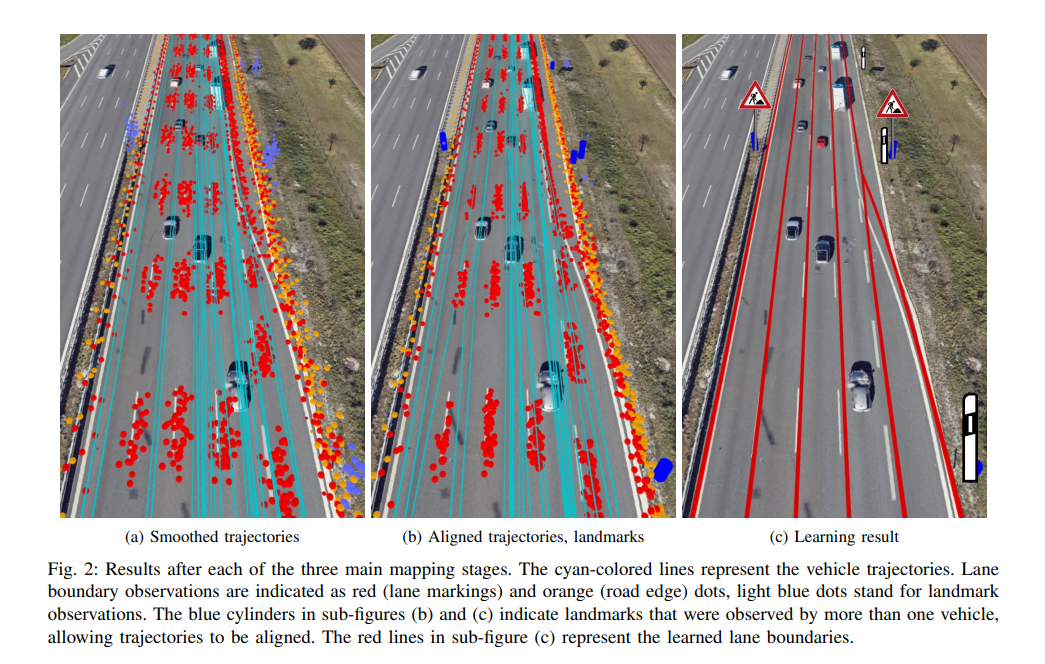
BMW
- Use GNSS and odometry to smooth the trajectory
- Align trajectories based on co-observations of 3D point landmarks
- Search for the lane-line configuration via discrete optimization
Comments